[OC] Ho creato una mappa tipografica della Finlandia usando i nomi delle sue località
https://i.redd.it/0ht7j0wb4jqf1.jpeg
di paveloush

[OC] Ho creato una mappa tipografica della Finlandia usando i nomi delle sue località
https://i.redd.it/0ht7j0wb4jqf1.jpeg
di paveloush
1 commento
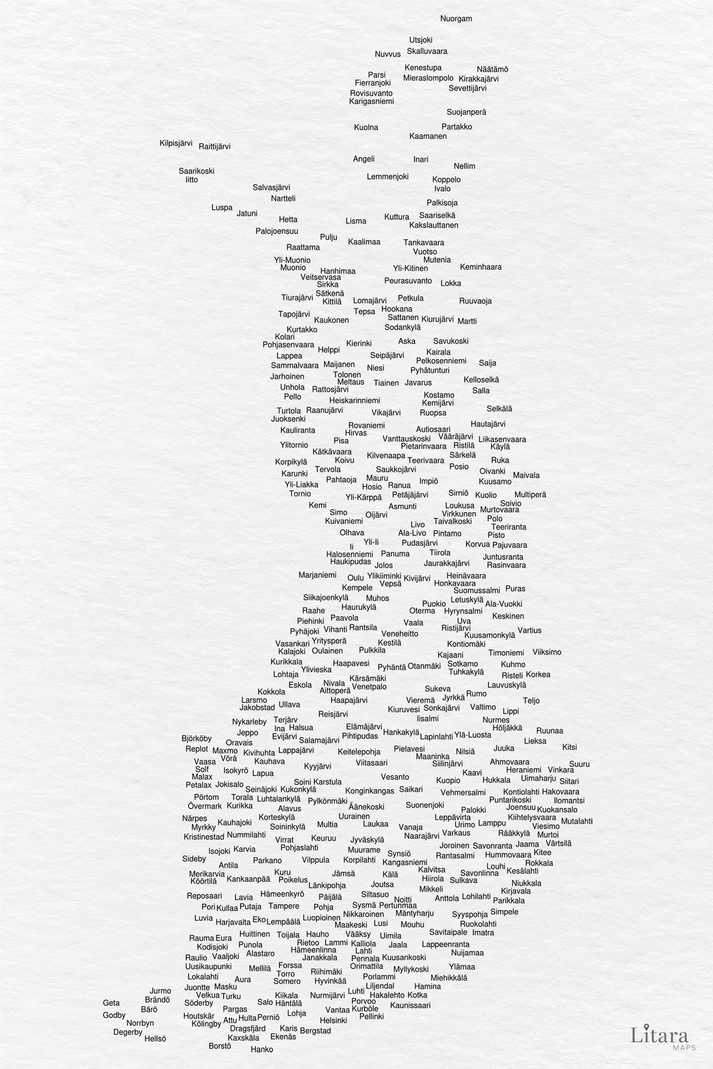
Hei everyone!
Thank you for checking out my personal geo-data-art project. I wanted to share a few notes on what you’re seeing, as it’s not a traditional map, but a piece of art designed to evoke emotion and show the country in a new light.
**1. Data Art, Not an Atlas**: Its goal isn’t navigation, but to visualize the geographic fabric of Finland in a unique, minimalist way. The final image is meant to be a beautiful art, a conversation starter that feels both modern and deeply connected to the country’s identity.
**2. The Process: “Geographic Tetris”**: I don’t “choose” the places. My own custom script processes a data and attempts to place each name at its exact coordinates, starting with the most populous. The key rule is: names cannot overlap. A large city in a dense area might be blocked by its neighbors, while a smaller, luckier town in a sparser region might find a spot.
**3. The Data: A Bilingual Snapshot:** The data comes from OpenStreetMaps, which means the map includes hundreds of municipalities, towns, and villages (489 actually on this map). A unique feature of the Finnish data is its bilingual nature. You’ll notice that while most names are in Finnish, localities in Swedish-speaking regions are shown in **Swedish**. The final result is an authentic snapshot of how the data sees Finland, with all its linguistic and historical layers.
Happy to answer any questions about the process!